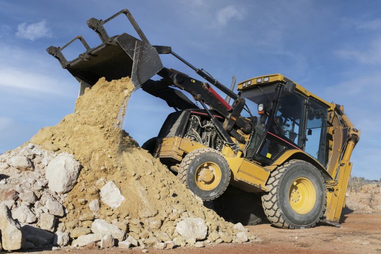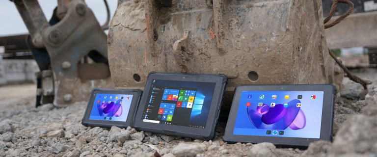

In the mining industry, where operations often occur in remote and challenging environments, reliable GPS and location tracking technology is essential. Mining operations rely heavily on precise geographic data to monitor the movement of equipment, vehicles, and personnel, as well as to optimize resource extraction and ensure safety. With the increasing use of mining tablets, these rugged devices are equipped with GPS and location tracking systems that provide real-time data, enabling better decision-making, resource management, and safety compliance.
But just how accurate are mining tablets when it comes to GPS and location tracking in remote locations? This question is critical because inaccurate data can lead to inefficiencies, safety hazards, and increased operational costs. In this article, we will explore the importance of GPS and location tracking in mining operations, the challenges of maintaining accuracy in remote areas, the factors that influence GPS performance, and the latest technologies that enhance the precision of mining tablets in the field.
The Importance of GPS and Location Tracking in Mining Operations
Mining operations, particularly those conducted in large open-pit mines or extensive underground networks, require precise GPS and location tracking for several key functions:
1. Equipment and Vehicle Tracking
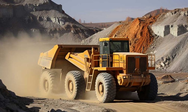
Mining involves the use of large, expensive equipment such as haul trucks, loaders, and drilling rigs. These machines operate across vast areas and require continuous monitoring to ensure they are being used efficiently and safely. Mining tablets with GPS tracking allow managers to monitor the real-time location and status of equipment, enabling them to optimize routes, reduce idle time, and prevent unauthorized use. Additionally, GPS tracking helps maintenance teams locate machinery quickly for routine servicing or emergency repairs.
2. Personnel Tracking and Safety
Mining is a high-risk industry, and ensuring the safety of workers is a top priority. Mining tablets equipped with GPS and location tracking help monitor the whereabouts of workers, particularly in hazardous areas such as underground tunnels or remote regions of the mine. If an emergency occurs, such as a collapse or gas leak, the ability to pinpoint the exact location of workers can facilitate a faster response, improving the chances of successful evacuation or rescue.
3. Resource Management and Exploration
In the early stages of a mining project, accurate GPS data is critical for geological mapping and resource exploration. Mining tablets allow geologists and surveyors to mark specific locations, record data, and analyze terrain features to identify the most promising areas for resource extraction. Precise location tracking also plays a role in monitoring extraction progress, ensuring that resources are being mined efficiently and in accordance with environmental regulations.
4. Environmental Monitoring and Compliance
Mining companies must comply with strict environmental regulations, particularly concerning land use and rehabilitation. Mining tablets with GPS tracking allow companies to map out areas of disturbance and monitor the progress of land reclamation efforts. Accurate location data helps ensure that mining activities do not encroach on protected areas or exceed the boundaries of authorized mining zones.
Challenges of GPS Accuracy in Remote Mining Locations
While GPS and location tracking are indispensable tools in mining operations, remote locations present unique challenges that can impact the accuracy and reliability of these systems. Understanding these challenges is essential for selecting the right mining tablet and implementing strategies to maintain precise location tracking.
1. Limited Satellite Coverage
GPS (Global Positioning System) relies on signals from satellites orbiting the Earth to determine a device’s location. In remote areas, particularly those located near the poles or in deep valleys, satellite coverage may be limited. This can result in weaker GPS signals, leading to reduced accuracy or even signal loss in extreme cases. Mining operations in remote regions may face difficulties obtaining a clear line of sight to enough satellites, impacting the precision of location data.
2. Terrain Obstructions
In mountainous or heavily forested areas, natural terrain features such as cliffs, ridges, or dense tree cover can block or reflect GPS signals, making it more difficult for mining tablets to determine an accurate location. Underground mining presents an even greater challenge, as GPS signals cannot penetrate solid rock, rendering traditional GPS tracking systems ineffective without the aid of additional technologies.
3. Multipath Errors
Multipath errors occur when GPS signals are reflected off nearby surfaces—such as buildings, vehicles, or rock faces—before reaching the mining tablet. These reflected signals take longer to reach the device, causing inaccuracies in the calculated position. This issue is especially common in environments with large metal surfaces, which are often present in mining operations due to machinery and equipment.
4. Weather Conditions
Adverse weather conditions, such as heavy rain, snow, or dense fog, can weaken GPS signals, reducing the accuracy of location tracking. While most modern GPS systems are designed to function in a wide range of weather conditions, severe weather events can still cause intermittent signal loss or decreased precision, especially in remote or rugged environments.
Factors That Influence GPS Accuracy in Mining Tablets
Several factors influence the accuracy of GPS and location tracking on mining tablets, particularly in remote and challenging environments. Understanding these factors can help mining companies choose the most suitable technology and improve the precision of location tracking in the field.
1. Number of Satellites in View
The more GPS satellites a mining tablet can access, the more accurate the location data will be. A minimum of four satellites is required to obtain a 3D position (latitude, longitude, and altitude), but accuracy improves significantly when five or more satellites are in view. In remote locations with clear skies, mining tablets may have access to more satellites, leading to improved precision. However, in areas with obstructions, the number of satellites visible to the device may be reduced, impacting accuracy.
2. GPS Receiver Quality
The quality of the GPS receiver in the mining tablet plays a critical role in determining the accuracy of location tracking. Higher-end GPS receivers are more sensitive to weak signals and can process data more accurately, even in challenging conditions. Some mining tablets are equipped with multi-band GNSS (Global Navigation Satellite System) receivers, which can access not only GPS satellites but also other satellite constellations, such as GLONASS (Russia), Galileo (Europe), and BeiDou (China). This improves the chances of obtaining accurate location data, even in remote areas.
3. Correction Services
In some cases, GPS accuracy can be enhanced through the use of correction services such as Differential GPS (DGPS) or Real-Time Kinematic (RTK) positioning. These systems provide additional data to correct for errors in standard GPS signals, improving accuracy to within centimeters in some cases. Mining tablets that support these correction services can offer significantly improved precision, making them ideal for tasks such as surveying, mapping, and equipment tracking.
4. Augmented Location Technologies
To overcome the limitations of traditional GPS in remote or underground environments, mining companies can implement augmented location technologies. These technologies include:
Inertial Navigation Systems (INS): INS uses accelerometers and gyroscopes to estimate a device’s location based on its movement, even when GPS signals are unavailable. Mining tablets equipped with INS can provide continuous location data in underground tunnels or areas with poor GPS coverage.
Wi-Fi or Bluetooth Positioning: In underground mines, where GPS signals cannot penetrate, location tracking can be achieved using Wi-Fi or Bluetooth beacons placed throughout the mine. Mining tablets can triangulate their position based on the proximity to these beacons, providing accurate location data even in the absence of GPS.
LoRa and Mesh Networks: In remote mining sites, long-range communication technologies such as LoRa (Long Range) or mesh networks can be used to transmit location data from mining tablets to a central monitoring system. These networks are particularly useful in areas where cellular coverage is limited or non-existent.
Technologies that Improve GPS Accuracy in Mining Tablets
The accuracy of GPS and location tracking on mining tablets has been greatly enhanced by advancements in technology. Several key technologies enable mining tablets to deliver precise location data, even in the most challenging environments.
1. Multi-Band GNSS Support
Multi-band GNSS receivers in mining tablets allow the device to access multiple satellite constellations, including GPS, GLONASS, Galileo, and BeiDou. By leveraging multiple satellite systems, the tablet can obtain more accurate location data, especially in remote areas where access to GPS satellites alone may be limited. Multi-band GNSS receivers are particularly effective in reducing the impact of multipath errors and improving location precision in obstructed environments.
2. High-Sensitivity GPS Receivers
High-sensitivity GPS receivers are designed to pick up weaker signals, making them ideal for use in remote or rugged environments where signal strength may be compromised. These receivers are capable of detecting GPS signals even in areas with partial obstructions, such as deep valleys, mountainous regions, or dense forest cover. For mining tablets used in remote exploration or fieldwork, high-sensitivity GPS receivers provide more reliable tracking.
3. SBAS (Satellite-Based Augmentation System)
SBAS is a network of ground stations and satellites that provides real-time corrections to GPS signals, improving accuracy and reliability. Mining tablets that support SBAS, such as the European EGNOS system or the American WAAS system, can achieve higher levels of precision by receiving correction data that compensates for errors in GPS signals caused by atmospheric interference or satellite clock inaccuracies.
4. Real-Time Kinematic (RTK) GPS
RTK GPS is one of the most precise positioning systems available, capable of delivering accuracy within centimeters. RTK works by using a base station and a rover unit (the mining tablet) to measure the relative position between the two. Correction data from the base station is transmitted to the rover in real time, resulting in highly accurate location tracking. Mining tablets with RTK capabilities are particularly valuable for tasks that require extreme precision, such as surveying, drilling, or blast design.
5. Dead Reckoning and Inertial Navigation Systems
When GPS signals are unavailable, mining tablets can use dead reckoning or inertial navigation systems (INS) to estimate their location. These systems use motion sensors, such as accelerometers and gyroscopes, to track movement and calculate position based on the last known GPS location. While not as accurate as GPS, dead reckoning and INS provide a valuable backup in environments where GPS signals are weak or nonexistent, such as underground mines.
Applications of GPS and Location Tracking in Mining Tablets
The ability to accurately track location using mining tablets has a wide range of applications in the mining industry, from improving operational efficiency to enhancing safety and compliance.
1. Fleet Management and Optimization
GPS-equipped mining tablets are used to track the real-time location of mining vehicles and equipment. Fleet managers can monitor the movement of haul trucks, loaders, and other machinery, optimizing routes to reduce fuel consumption and idle time. GPS tracking also helps prevent unauthorized use of equipment, reducing the risk of theft or misuse.
2. Worker Safety and Incident Response
Accurate location tracking is essential for ensuring the safety of workers in hazardous mining environments. Mining tablets can monitor the location of personnel, enabling supervisors to quickly identify any workers who may be in danger during an emergency. In the event of an incident, GPS data can be used to guide rescue teams to the exact location of trapped or injured workers, improving response times and potentially saving lives.
3. Geological Mapping and Exploration
GPS-enabled mining tablets are widely used by geologists and surveyors to map out potential resource deposits. By marking specific locations and recording geological data in real time, these tablets allow for more efficient exploration and resource assessment. GPS data can also be integrated with GIS (Geographic Information System) software to create detailed maps of mining sites, aiding in the planning and execution of extraction operations.
4. Environmental Monitoring and Land Reclamation
Mining companies are required to monitor the environmental impact of their activities and comply with regulations concerning land use and reclamation. Mining tablets with GPS tracking can be used to map out disturbed areas, monitor vegetation growth, and track the progress of land rehabilitation efforts. Accurate location data ensures that mining activities are confined to authorized areas and helps demonstrate compliance with environmental standards.
In the mining industry, where operations often take place in remote, rugged, or hazardous environments, accurate GPS and location tracking are essential for optimizing efficiency, ensuring worker safety, and complying with regulations. Mining tablets equipped with advanced GPS technology offer precise location data, enabling real-time tracking of equipment, personnel, and resources.
While remote locations present challenges such as limited satellite coverage, terrain obstructions, and multipath errors, advancements in GPS technology—such as multi-band GNSS support, high-sensitivity receivers, and RTK positioning—have greatly improved the accuracy and reliability of mining tablets in the field. By leveraging these technologies, mining companies can enhance operational efficiency, reduce costs, and improve safety outcomes.
Investing in mining tablets with robust GPS and location tracking capabilities is a strategic decision that enables mining companies to navigate the complexities of remote operations with greater precision and confidence. As the technology continues to evolve, mining tablets will become even more indispensable tools for location-based data management in the modern mining industry.